


Peering several thousand feet down into the fifth canyon of the North Nahanni, I strained to recall what I had seen down in the depths of this slot six days previously when we had scouted the canyon by bush plane. After paddling through four canyons since that flight, my memory was getting hazy.
Seven days earlier after a two hour bush plane flight we unloaded our gear and began hiking down towards the headwaters of the North Nahanni River, a 200 mile tributary of the Mackenzie river. After an hour of walking through the tundra we arrived, setting up camp at waters edge. As the never ending sunset of the northland continued we fell asleep dreaming of the days on the river to come.
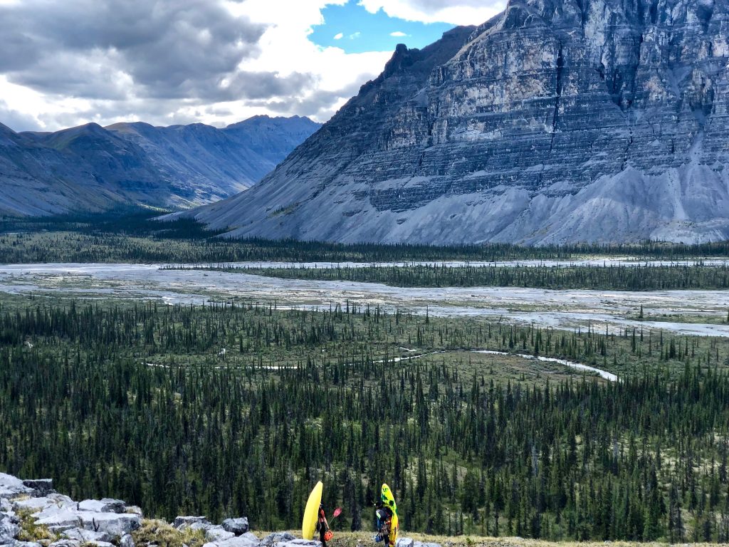
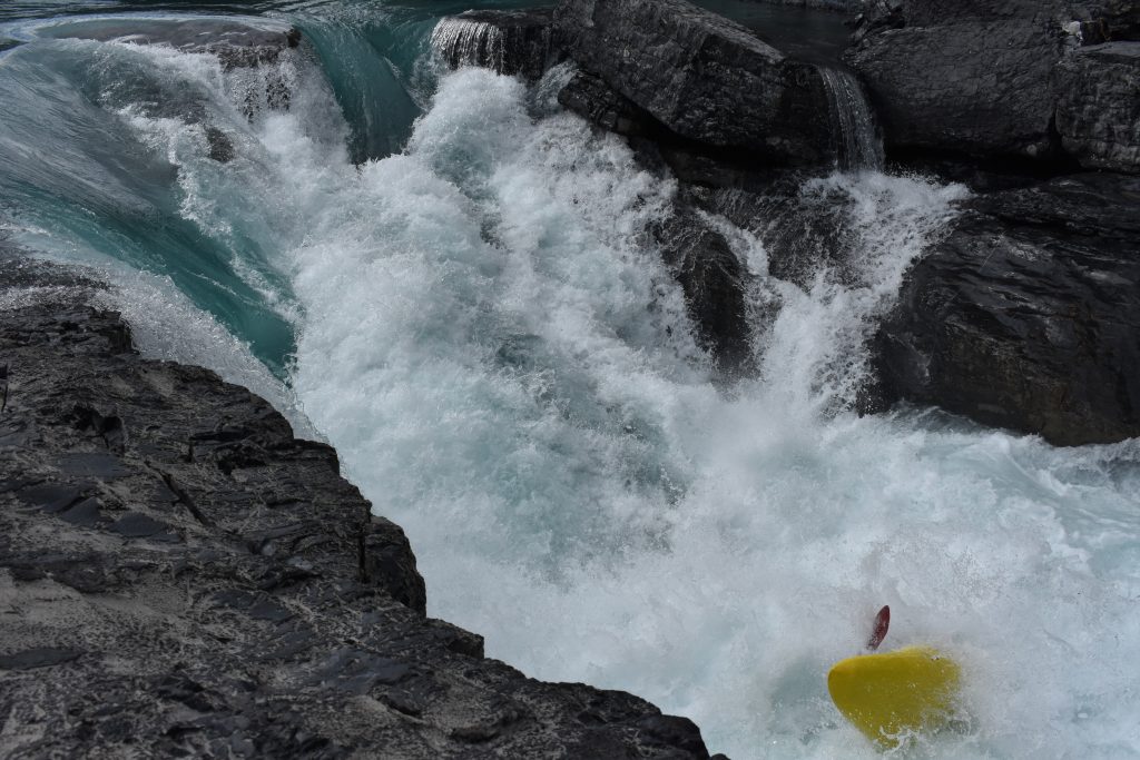
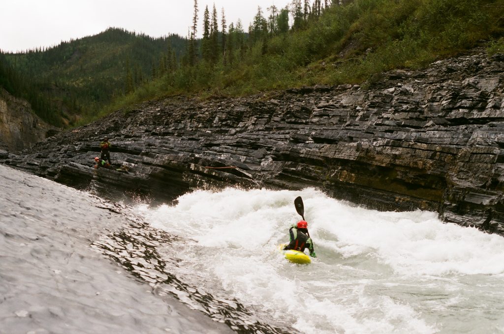
The first three days on the river we made quick progress, paddling through four of the North Nahanni’s major canyons. The first canyon contained the most challenging whitewater of the trip with several steep powerful cascades and surging corridors. While the whitewater was difficult in the first canyon, the biggest challenges lay downstream as the canyon walls grew larger.
Canyons two, three, and four had looked mellow from our scout flight and we paddle through them with relative ease enjoying the class three and four rapids.
On the fourth day, we paddled through the first half of the fifth canyon. The walls were dark and a foreboding storm set the mood as we paddled through the canyons quality whitewater. After a full day of running great rapids we camped in a spot where the canyon briefly opened up. Unbeknownst to us as we fell asleep that night, three days later we would have only moved one mile downstream from that camp.
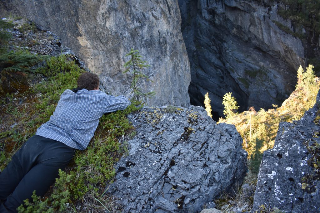
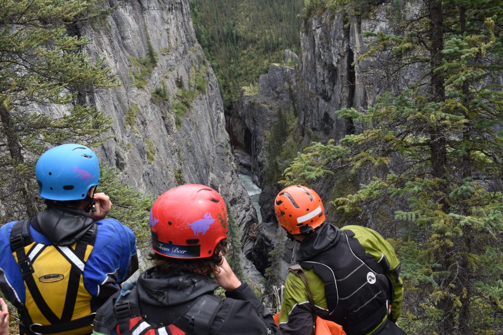
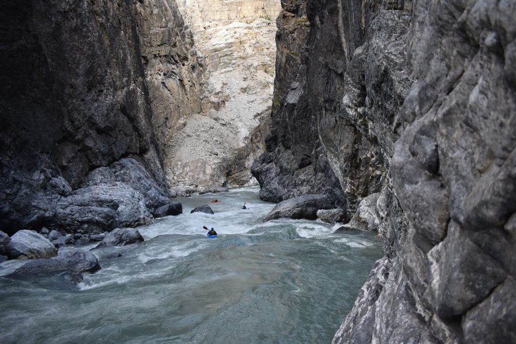
Putting on the fifth morning, rapids began right around the corner. Soon we were climbing up the limestone cliffs doing an extended scout of a narrow section of river. Three of us scouting on the left and three on the right. The canyon was so narrow you could almost jump across from rim to rim. Five days earlier, we had spotted a section of river on our flight in that looked like it went under ground. Was this the section? We all hoped it was as we got in our kayaks and paddled into the gorge after deeming it good to go.
With the previous gorge still in sight, we all got out for another extended scout as the river appeared to be going into a much deeper section of canyon. As we got a look at what lay downstream, we knew that we had not yet passed the feared section of subterranean river. We watched as the water disappeared into rock and entered one of the deepest canyons I have ever seen.
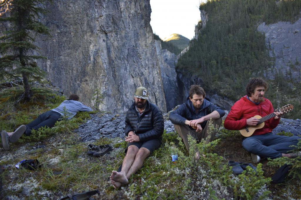
At 10 am we made camp and started problem solving. For the remainder of the day we hiked along both river left and river right trying to located a potential route for re-entering the canyon should we choose to finish the gorge at river level. If we chose the alternative, we would be faced with a multi-day portage over the final ridge of the Mackenzie Mountains before the terrain flattened into the plains.
Our only potential option for re-entering the canyon was on river right. The following day we ferried across the river and began portaging high out of the canyon, feasting on blueberries during breaks. Making our way back towards the river, we left our kayaks on a ledge, still 700 feet above the river. After scrambling around on the cliffs, we found a potential rappel route that could get us back to the river. Still uncertain of what lay downstream, however we spent the remainder of the day scouting the rest of the gorge.
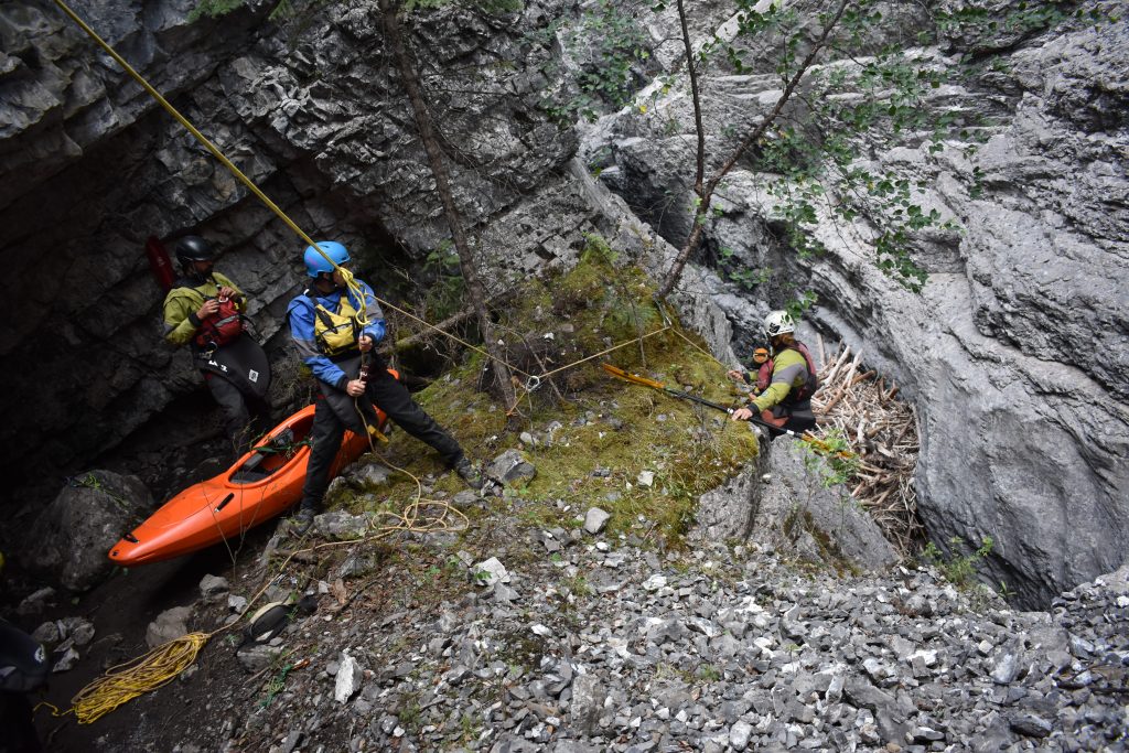
Even after a full day of scouting on river right, one section of river still remained a mystery. Pinched tightly between the towering cliff walls, we were unable to see into this deep and dark corridor. The following day we split up the tasks at hand. Ben and Nate portaged back upstream, crossed the river, and hiked down river left to get a view into this questionable pinch. The rest of us began to set up a rope system to lower ourselves and our kayaks back into the canyon. After several hours of rope work, we confirmed that we could reach the river. Ben and Nate returned from their scout with good news, informing us that the corridor in question was runnable! We relaxed that evening, camping on the cliff edge, knowing we would be finishing off the North Nahanni at river level.
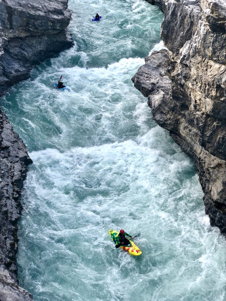
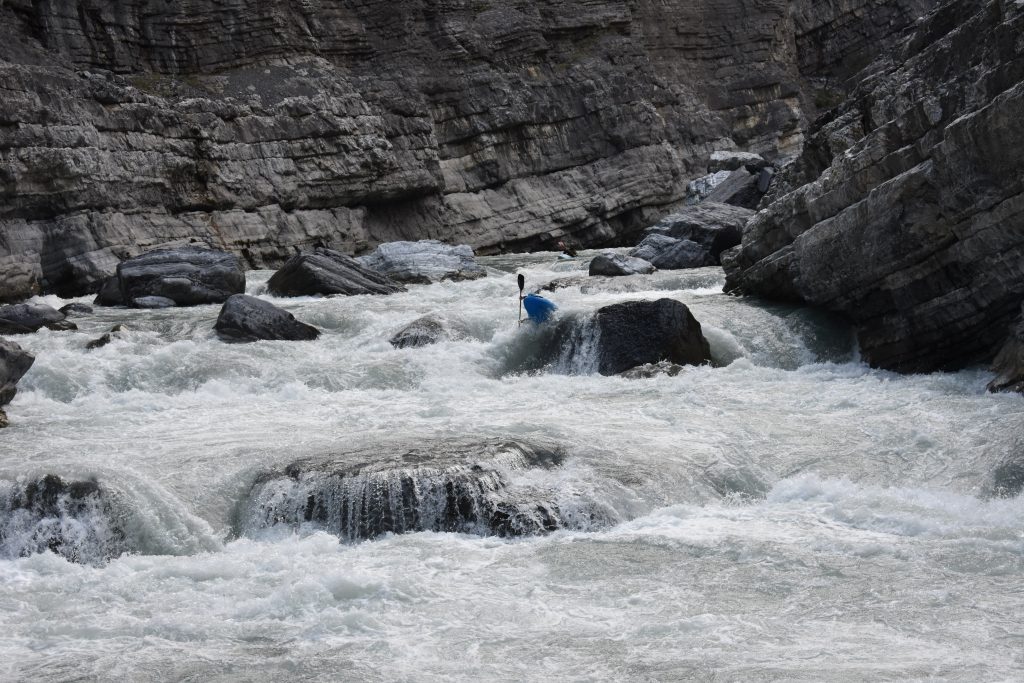
The following morning, we scrambled down to our rope system and began lowering into the canyon, one at a time, to a small ledge ten feet above the river. The ledge was only big enough for two, so we planed to seal launch in and regroup downstream. After many hours of lowering, the whole group was reunited in the canyon. We ate a quick lunch and the rest of the afternoon was filled with scouting and running beautiful big water rapids.
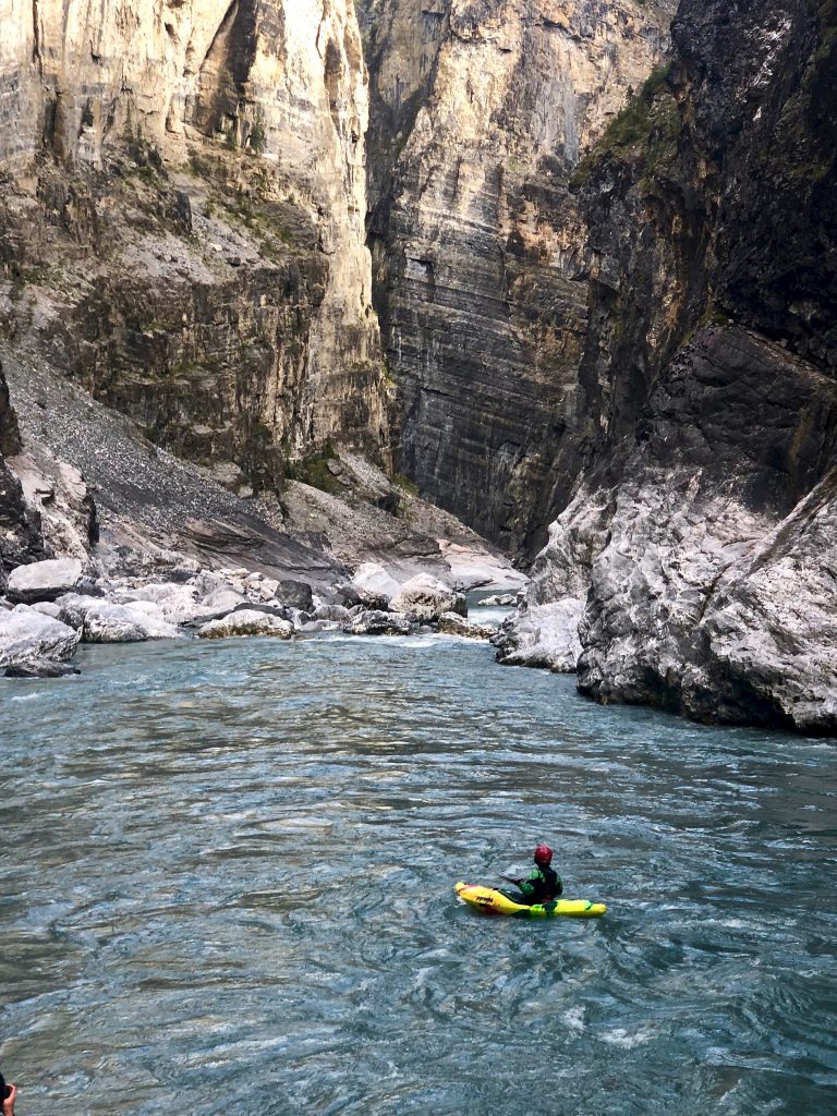
After the river cut through the last ridge in the Mackenzie Mountains, the canyon walls receded. Very few words were spoken as we exited the canyon, still processing the surreal whitewater and the towering cliffs we had just paddled through. Hoping to make progress on the 100 miles of flat water ahead, we paddled into the night being led by the northern lights.